
|
Cartografx offers the World Navigator family
of mapping software products tailored for your particular needs.
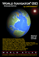
World
Navigator Standard Edition (SE) – This Windows 7 / Vista / XP
/ 2000 world atlas program and cartographic database is suitable for anyone with an
interest in geography. Designed to be used by people of all ages, World
Navigator (SE) is perfect for students working on reports for school as well
as for armchair world travelers who want to learn more about other countries
that are far from home. It comes with political and topographical
databases and a complete set of navigation tools that allow you to easily
travel around the world, zoom in and out, search our database of over 2.7
million place names, and create and save maps anywhere in the world. Click here to learn more or click
here to order. This product comes with
a license agreement that allows you to use the map images created by the
program for your personal (non-commercial, non-business) use only. Click here to view a copy
of the actual license agreement that comes with World Navigator (SE).
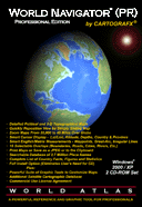
World
Navigator Professional Edition (PR)
– This Windows 7 / Vista / XP / 2000 world atlas program and cartographic database is suitable for
graphic artists or individuals in the corporate, government, or education
world who need to create royalty free maps (subject to the restrictions
contained in the license agreement) for commercial or business use. It
comes with all the features of the Standard Edition above plus powerful
graphic tools that can be used to create truly customized maps. In
addition, it comes with an additional cartographic database that is based
upon satellite imagery. Click here to learn more
or click
here to order. This product comes
with a license agreement that allows for the commercial use (see actual license
agreement for details) of the map images created by the program. Click here to view a copy
of the actual license agreement that comes with World Navigator (PR).
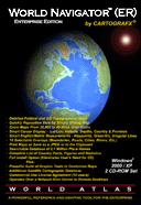
World
Navigator Enterprise Edition (ER) – This Windows 7 / Vista / XP / 2000 world atlas program and cartographic database is suitable for
corporate, government, or education use over a network (or on stand alone
PC's) and allows for the creation of royalty free maps (subject to the
restrictions contained in the license agreement). It comes with all the
features of the Professional Edition above plus it can be run over a network
of computers. Click here to learn more
or click
here to order. This product comes
with a ten (10) user license agreement that allows for the use of the program
over a network or it may be installed on ten (10) individual PC's within your
organization. It also allows for the commercial use (see actual license
agreement for details) of the map images created by the program. Click here to view a copy
of the actual license agreement that comes with World Navigator (ER). Enterprise users needing more than ten
license agreements, please contact sales at info@cartografx.com.
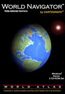
World
Navigator Web Server Edition
– This Windows Server world atlas program and cartographic database is suitable for corporate,
government, or educational users that wish to incorporate maps into their web
sites. It allows for the creation of royalty free maps (subject to the
restrictions contained in the license agreement). Click here to learn more. Click here to view
a copy of the actual license agreement that comes with World Navigator Web
Server Edition. |
![]()
|
World Navigator Family of PC / Workstation Products
|
|||
|
|
World Navigator Edition |
||
|
|
SE |
PR |
ER |
|
|
Std. |
Pro. |
Ent. |
|
Price (USD) |
|||
|
Features |
|
|
|
|
Political Maps |
x |
x |
x |
|
Topographical Maps |
x |
x |
x |
|
Satellite Maps |
|
x |
x |
|
Full Navigation
Controls (1) |
x |
x |
x |
|
Full Search
Capabilities (2) |
x |
x |
x |
|
Full Map Overlay
Capabilities (3) |
x |
x |
x |
|
Save Map Image as
JPG file (4) |
x |
x |
x |
|
Copy Map Image to
Clipboard |
x |
x |
x |
|
Print Map Image |
x |
x |
x |
|
Country Facts and
Statistics |
x |
x |
x |
|
Personal Use of Map
Images |
x |
x |
x |
|
Commercial Use of
Map Images |
|
x |
x |
|
Full Set of Map
Tools (5) |
x |
x |
x |
|
Full Measurement
Options (6) |
x |
x |
x |
|
Copy Database to
Hard Drive (7) |
x |
x |
x |
|
Motion Capture Capabilities
(8) |
|
x |
x |
|
Manual Control of
Map Image Size (9) |
|
x |
x |
|
Country/Province
Highlight with Extrusion (10) |
|
x |
x |
|
Manual Control of
Satellite Map Colors (11) |
|
x |
x |
|
Manual Control of
Boundary Display (12) |
|
x |
x |
|
Manual Control of
Transportation Features Display (13) |
|
x |
x |
|
Manual Control of
Map Component Colors (14) |
|
x |
x |
|
Runs on Individual
PC with Single User License Agreement |
x |
x |
|
|
Runs on Individual PC's
or on a Network with 10 User (or more) License Agreement |
|
|
x |
|
|
SE |
PR |
ER |
|
|
Std. |
Pro. |
Ent. |
|
|
|||
|
(1) Full
navigation controls - are accessed through use of the mouse and the program's
main menu items "Move", "Zoom In", and Zoom
Out". The program allows you to drag the map by depressing and
holding down the left mouse button; to spin the globe or map by moving the
mouse cursor out to the edge of the map and depressing and holding the left
mouse button; to zoom in or out using the mouse wheel; and to zoom in by
opening a zoom box on the map identifying the area which you wish to zoom in
on. The program's main menu has an item labeled "Move" that
allows you to specify the latitude, longitude, and altitude of the next map.
The main menu's "Zoon In" and "Zoom Out" items are self
explanatory. |
|||
|
(2) Full
search capabilities - are accessed through the use of the program's main menu
item "Search" which consists of four submenu items: (a) "Draw
a Country or Province Map ..." presents you with an alphabetized list of
all the countries and provinces / states in the world, selecting any one of
which will result in the program drawing a map of the selected place; (b)
"Display Country Facts ..." presents you with an alphabetized list
of all the countries in the world, selecting any one of which will result in
the program displaying an extensive textual and statistical description of
the selected country; (c) "Find any City, Town, or Village ..."
allows you to type in the name (partial or complete) of a populated place
while the program searches its database of over 1.7 million names and
displays all the populated place names that match your request; it will then
draw a map of the one you select; (d) "Find any Natural Feature ..."
allows allows you to type in the name (partial or complete) of a natural
feature (lake, river, mountain, bay, island, etc.) while the program searches
its database of over 1 million names and displays all the place names that
match your request; it will then draw a map of the one you select. |
|||
|
(3) Full map overlay
capabilities - are accessed through the use of the main menu item
"Options" and then its first submenu item "Map Options
...". It allows you to select up to 17 different layers of data
that are then drawn on top of the selected base map (political,
topographical, or satellite) . These selectable layers include
rivers and lakes, international and national boundaries, streams and canals,
highways, railroads, airports, populated and natural feature place names, and
more. You can select all of them, a few of them, or none at all to
produce a map that contains only the data you wish to see. |
|||
|
(4) Save Map Image
as JPG file - allows you to save any map image to a jpg formatted graphics file
and it allows you to specify the resolution of the file (higher resolution,
larger file size; lower resolution, smaller file size). |
|||
|
(5) Full Set of Map
Tools - are accessed through the use of the program's main menu item
"Tools" which consists of three submenu items: the "Location
Readout" display, the "Map Legend", and the "Measure
Distance" tool. The "Location Readout" display is a
floating dialog box that tells you the latitude. longitude, and altitude of
your cursor over the map, as well as the terrain elevation or ocean depth
underneath the cursor. It will also identify the country and province
or body of water underneath the cursor. The "Map Legend" is
self explanatory. Finally, the "Measure Distance" tool allows
you to measure the great circle distance between a series of points and it
also allows you to measure the distance along any "squiggly" line
you draw with the mouse cursor. |
|||
|
(6) Full Measurement
Options - are accessed through the use of the main menu item
"Options" and then its first submenu item "Measurement Options
...". It allows you to specify which units of distance are used by
World Navigator, US/English or metric; and it also allows you to specify
which units of angular measurement are used by the program, degrees, minutes,
and seconds, or decimal degrees. |
|||
|
(7) Copy Database to
Hard Drive - allows you to copy the cartographic and informational databases
to your computer's hard drive eliminating the need to have the CD-ROM in the
computer every time you run World Navigator. |
|||
|
(8) Motion Capture Capabilities - allows you to generate a
sequence of JPG map images to be used in creating a JPG animation
sequence. The program will allow you to have as many as 10 maps in your
sequence with as many as 9999 intermediate maps between any two maps in your
sequence for a total of 90009 map images. The motion capture feature
was used to create most of the images that are used in the World Navigator
demo video found on the detailed products page. |
|||
|
(9) Manual Control
of Map Image Size - allows you to manually specify (subject to certain
limitations) the number of pixels and number of raster lines of the map image
drawn by the program. This feature is useful when a map image of a
desired size is needed. |
|||
|
(10)
Country/Province Highlight with Extrusion - allows you to select a country or
province to be continuously highlighted; it also offers the option of
extruding the country or province as well as presenting it against a white
background rather than against a background of the other countries and
provinces. |
|||
|
(11) Manual Control
of Satellite Map Colors - allows you to manually control the satellite
database map color, including both land and water. |
|||
|
(12) Manual Control
of Boundary Display - allows you to manually control the color and thickness
of all international and national boundary lines. |
|||
|
(13) Manual Control of
Transportation Features Display - allows you to manually control the color
and thickness of all highways and control the color of all railroads. |
|||
|
(14) Manual Control
of Map Component Colors - allows you to manually control the color of all
water in the political database as well as the color of all populated areas
in all three databases. |
|||
|
|
|||
|
Copyright © 1997-2012 Cartografx Corporation. All rights reserved. |